
Ammassilik Maps
Back in September 2025 Wood Carving London were contacted by The Royal Museums Greenwich and asked if we were able to create facsimiles of the Ammassillik maps that they could display and use as part of their handling collection at The National Maritime Museum
Currently on display at the Greenland National Museum these hand carved artifacts are considered to be the rarest form of map in the world as there are only 3 remaining examples in existence.
The maps are small hand carved tactile wooden objects that represent parts of the eastern Greenlandic coastline, traded in 1885 by an Inuit hunter to a Danish navel officer.
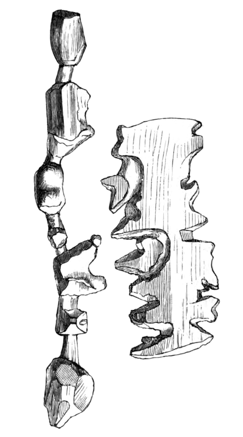
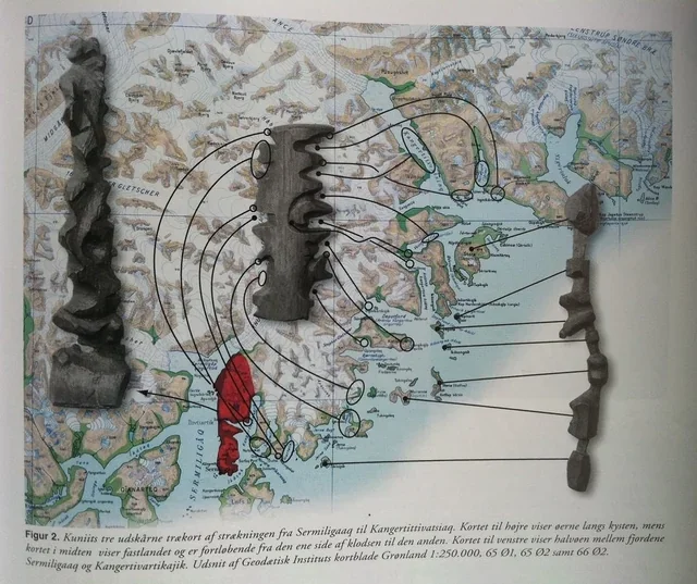
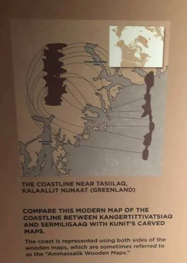
One carving is 5.5 inches in length and records a stretch of the mainland coastline. It’s read in a continuous stretch up one side and down the other and even indicates locations where a traveler would need to carry their kayak overland to get to the next fjord. The other carving measures just over 8.5 inches long and depicts a specific chain of islands along the coast, connected by narrow stems. These two maps could be placed next to each other to demonstrate the relative positions of the islands along the coast. They are small enough to be held inside a glove or mitten and due to their tactile nature kayakers were able to feel their way along the coast line from one bay to the next
As very few trees grow in Greenland the maps were almost always carved from driftwood, they were small in size, meaning they were easily portable and would float if dropped overboard
Woodcarving was a common activity among the Tunumiit people of Greenland and carving maps was not out of the ordinary and often recorded important information about people and places. A wooden relief map, would have served as a storytelling device, that could be discarded after the story was told. As geographer Robert Rundstum noted, in Inuit tradition, the act of making a map was frequently much more important than the finished map itself.
In 2024 Carnegie Mellon University sent a laser-etched image of one of the maps to the Moon as part of the MoonArk project, comprising a selection of art, science, and technology and demonstrating the significance of these items .
Some time ago!!!???? Resin casts were produced from the original maps and wood carving London were lucky enough to have them in our workshop in order to make authentic copies.
At first the decision was made to make the maps from drift wood and during our travels we searched for suitable pieces of timber in both Denmark and the north coast of Ireland however none of our finds were deemed suitable so in the end we opted to use yellow pine as it is indigenous to many parts of the neighboring regions of Greenland
Having spent some time studying the form of the carvings It was apparent that they had been made using a sharp knives but we also observed how blunt tools had been used to make many of the markings.
Using only a knife and some basic hand tools we were able to cut and scratch out the unique shapes.
While accepting that we were unable to produce precise replicas of the maps due to the unique properties, structure and age of the wood, we tried to recreate copies that preserve the essence and overall character of the originals and endeavoured to replicate them as best as we could.
The decision was made to leave the maps in their natural colour as they would have once looked whilst also differentiating them for the originals.
The new carvings have been delivered and are now safely stored at the national Maritime museum amongst countless other wooden artefacts from around the world relating to maritime history.
They are set to be featured in an upcoming exhibition at the Grenwich Maritime Museum.